- Walked: 17th Feb 2007.
- Distance: 9m
- Walking time 4 hrs
- Terrain: some inclines
- Summary: Hartshorne to Dimminsdale Nature Reserve and back.
- map: Explorer 245
Snowdrops are among the first flowers to emerge from the ground when the Winter starts to recede and the days start to grow longer. Dimminsdale is a nature reserve at the southern point of Staunton Harold Reservoir, on the Derbyshire / Leicestershire border, and at this time every year you can see a spectacular display of snowdrops there heralding Spring.
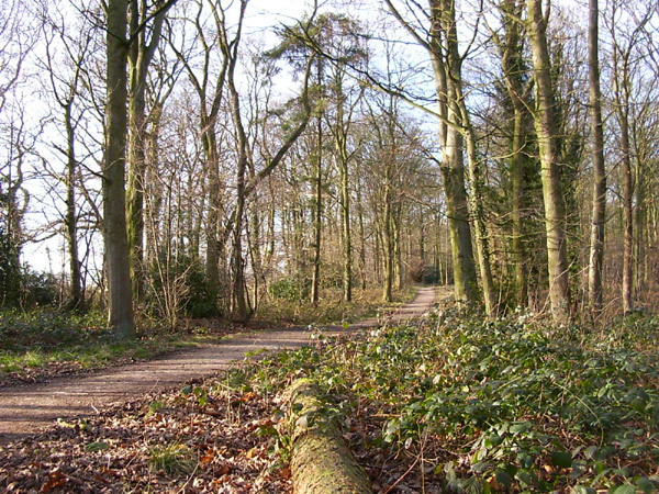
This walk starts from Hartshorne. We joined the footpath just opposite the Admiral Rodney pub; it crosses a couple of fields and a road before joining part of the the National Forest. This is what the National Forest looks like in the winter:

A bit uninspiring today, but The National Forest is a fantastic idea: "plant lots of trees". It's a shame that they're not being planted at the same rate we're cutting down forests in other parts of the world, but hey. Even the more mature parts of the Forest are still very young in tree years, and I felt sorry for these fairly new trees in their winter plumage on this bleak foggy day.
I've mentioned Daniel Hayes before; it provides the best views of South Derbyshire. This time we skirted around the hill, but well worth the climb to the top.
Another one of these tumbledown houses - this was very creepy - we gingerly explored inside and found ivy starting to take over - nature quickly reclaims her land!

This is the more mature South Wood - even this one is a bit bleak at this time of the year.

You emerge to join the Ivanhoe Way (a 36-mile walk around Leicestershire) which leads to Dimminsdale, and this is the wonderful carpet of snowdrops.


On the way back I found out what it feels like to touch an electric fence. I don't know how many volts they give, but it made me shout. I don't remember touching one before, and it'll be a long time before I do the same again! The horses in the field seemed to be laughing in a knowing way.

The route and distance statistics above were generated using Meander.
Image produced from the Ordnance Survey Get-a-map service. Map image reproduced with kind permission of Ordnance Survey and Ordnance Survey of Northern Ireland.