Distance: officially 36m (I've not checked this yet) plus a couple of miles for one deliberate detour and going 'off track' a couple of times.
Weather: To start with, it was misty and drizzly at best and raining at worst. It brightened up during the morning and the rest of the day was warm and pleasant.
I've had my heart set for three years on walking the whole Ivanhoe Way in a day. I had big ideas about planning where I'd be at what time, and inviting friends to join in for parts. However, with the day length closing in, and a reasonably fine bank holiday forecast, I decided almost on the spur of the moment just to go for it.
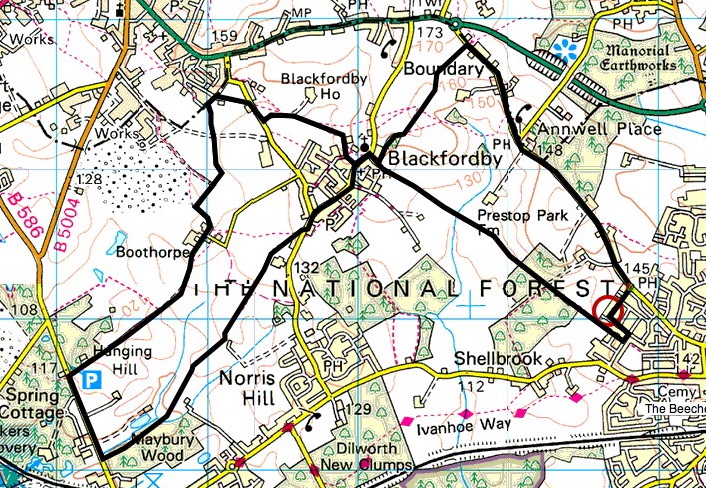
The route almost passes my house, and so the obvious plan would be to start and finish from home. Instead, my more cunning plan was to drive to the other side, so that half way round I'd arrive at my house to top up on food and water, meaning I wouldn't have to carry all of the provisions I'd need for the day. Therefore I parked at Billa Barra car park, which is between Stanton-under-Bardon and Bardon Hill. I walked the route anti-clockwise, though I don't think there's a right or wrong way to do it.
For once I remembered to set the time on my camera, so I know where I was when.
I intended to start at 6am, as it was getting light. It was around 6:15 when I arrived at Billa Barra, and I waited for a bit because it was raining. I started walking at 6:30am
6:45 am. This first picture shows Bardon Hill. Or at least the camera is pointing towards Bardon Hill. It's somewhere in that mist.

7:11 am. I'd usually enjoy a coffee and enjoy the view from the top of Bardon Hill - said to be the highest point in Leicestershire (which isn't saying much). You can see this radio mast from the A511.

This is usually a great view of Leicestershire and I've taken this picture before on sunny days. not very exciting today! There was little point hanging around.

There are then a couple of housing estates to walk through. I took a wrong turn in Bardon (Didn't look at the map, thought I knew my way through. One street in a housing estate looks much like another!) That added a mile. There's another council estate to get through at Whitwick, but no problems there. (Give me fields and hedges anytime!)
8:18 am. My photo isn't very good, but the arrow disc says 'Ivanhoe Way' in it. Leicestershire County Council are brilliant when it comes to waymarking. There are plenty of these yellow posts, or the green fingerposts; usually the next one is in sight of the previous one. However, you can't rely on them, the OS map is essential.


9:00 am. This is the first time I stopped for coffee and cake. I crouched under a tree, the driest spot I could find, but it still wasn't very nice. Before I moved on, though, I realised it was getting brighter and saw the first glimpse of blue sky.

9:18 am. Swannington has an old inclined railway (trains were winched up a steep bit of track) which is still there as a museum piece. The Ivanhoe Way just misses it though. I don't know what this metal structure is, but it looks like it was something to do with mining.

10:39 am. This is my first view of Breedon church. Between Worthington and Staunton Harold was field after field of maize, with unpleasantly unkempt paths. This very long grass was still saturated from the rain.

12:09 pm. This is one of my favourite South Derbyshire photo opportunities (we're right on the border of Leicestershire and Derbyshire). I've taken lots of photos from The bottom end of Staunton Harold Reservoir, and it always looks slightly different. The water's still covered with algae, and there's a good reflection today.

3:22 pm. Half-way through now. If I cheated slightly, it was stopping at my house to freshen up a bit and have a hot dinner. (I resisted the temptation to have a shower!) However, I did take a bit of a detour around Ashby to do it, which added a mile or two to my journey. Just south of Ashby here, I like this view. My house is on the horizon, left of centre. We're in the National Forest here, and typically, the trees are still only head-high.

3:51 pm. This picture sums up the season. Blackberries and elderberries together. I stopped many times to pick the former to eat on the spot, and will be back for a bucketful of the latter to make this year's elderberry wine!

3:55 pm. Ashby to Measham is one of my favourite parts of the Ivanhoe Way. This is Moira Furnace, it is a fascinating building with a fascinating history. Unfortunately, I've just missed the furnace itself off this photo.

4:13 pm. After a lovely walk along canal and through woods, this is Donisthorpe church. It has some fascinating recent stained glass representing the mining heritage and new forestry and tourism industries. from here to Measham is cycle path, so easy walking and pleasant views.

6:32 pm. 12 hours' walking! Stops for drink and food seem to be getting more frequent, although things seem to hurt more when you re-start after resting for a while! After a stop for something to eat and drink in Snarestone, there's a little bit of surprisingly beautiful road here in Shackerstone. The Ivanhoe Way just goes off the bottom of Explorer 245 at this point, and so when walking here previously I've always taken a bit of a detour in order to stay on the map. I decided to try sticking to the Ivanhoe Way today, relying on the fingerposts, a strategy which very nearly worked.

7:44 pm. Almost to Odstone. It was still bright, but check out those long shadows - the sun is really low now. At this point I was still optimistic that I'd finish before it was completely dark.

8:10 pm. Just before Nailstone was this beautiful sunset.

The beautiful Nailstone church nestles among 20th century council houses!

At this point it got too dark to take any more pictures, and with quite a few miles to go, I panicked a little about what to do. When I came to Bagworth it was completely dark (stars but no moon) and with a few fields and woods to cross, I very nearly called a taxi.
The remaining paths go in very straight lines, and although it's obviously difficult or impossible to see the waymarkers, I could see my map and compass by torchlight, and pick out hedges and field boundaries and so very tentatively decided to carry on. Each stile or waymarker that I came to was a mini-triumph, and with a new determination dulling the pain a little, and a real peaceful atmosphere and even more of a sense of solitude than usual, I enjoyed walking in the darkness very much.
I arrived back at my car at 10:30pm - stung, sunburned, bitten, mud and blackberry-stained, sweaty, but very happy - 16 hours after setting off.